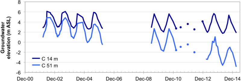
Figure 2.

Hydrographs of a very shallow, high-arsenic well (14 m bgl) and a shallow-depth, low-arsenic well (C5 in this study, 51 m bgl) at the location of multi-level nest C, designated by the large blue square in Fig. 1(a). Hydraulic head data since 2001 indicate a steadily declining water level of the deeper, low-As well, and thus an increasing downward vertical hydraulic gradient between the shallowest and the deepest wells at this site.
