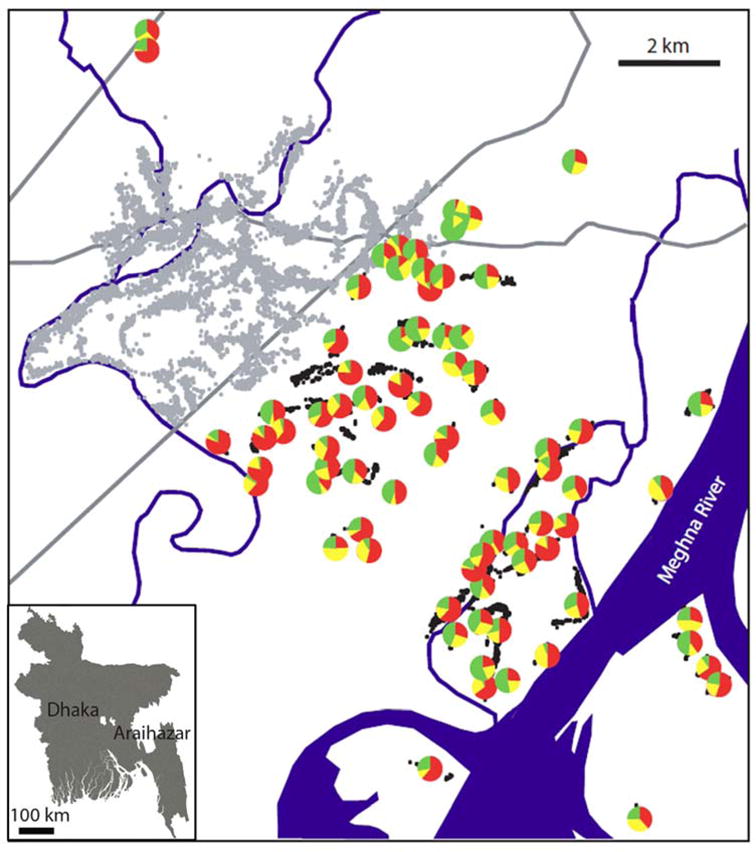
Figure 2.

Map of Araihazar upazila showing as pie diagrams the location of the 76 villages surveyed in 2005. Each pie diagram indicates the well status reported by the household: safe (green), unsafe (red), or unknown (yellow). The position of individual wells in the HEALS study area is show as grey dots; the position of wells surveyed under this study as black dots. The HEALS clinic is located at the intersection between the two major roads through the area, which are shown as grey lines. The inset shows the location of Araihazar and the Dhaka metropolitan area in Bangladesh.
