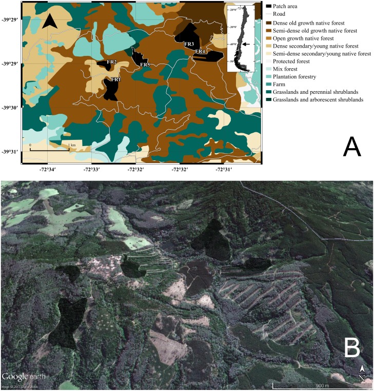
Figure 1. GIS representation and satellite image of the study site.
(A) Land uses, roads, and native forest patches (fragments “FRX”) where individuals of Oligoryzomys longicaudatus were sampled. (B) Google Earth image of the study site depicting the fragments and the high heterogeneity of the land uses. Map Data: Google Earth, DigitalGlobe.

