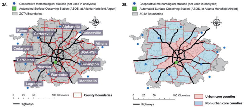
Figure 2.
Study area maps for 20-County Atlanta. Figure 2A presents the names and locations of the 14 meteorological monitoring stations across 20-county Atlanta. Figure 2B presents the spatial distribution of urban core and non-urban core counties and the cooperative monitoring stations within these areas. Main epidemiological analyses used temperature data collected from the Automated Surface Observing Station (ASOS) at Atlanta Hartsfield International Airport. Temperature data from the cooperative meteorological stations were used in sensitivity analyses. Urban counties (> 250,000 population and 1000 people/square mile): Clayton, Cobb, Dekalb, Fulton and Gwinnett Counties. Non-urban core counties: Barrow, Bartow, Carroll, Cherokee, Coweta, Douglas, Fayette, Forsyth, Henry, Newton, Paulding, Pickens, Rockdale, Spalding, and Walton. Abbreviations: UGA-PSF, Plant Sciences Farm associated with the University of Georgia (UGA), Bogart, GA; ZCTA, ZIP code Tabulation Area.

