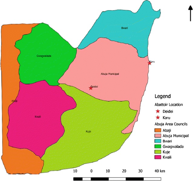
Fig. 1.

Map of Abuja showing the study area. This map highlights the six area councils in different colour codes namely: Abaji, Bwari, Kwali, Kuje, Gwagwalada and Abuja Municipal area councils. Our study was done at two abattoirs with high volume of daily slaughter of food animals (Karu, a government owned abattoir and Dei-Dei, a privately owned abattoir) located in the Abuja Municipal area council.
(Source of the Map is the Federal Ministry of Agriculture and Rural Development, Abuja, Nigeria)
