
Fig. 2.
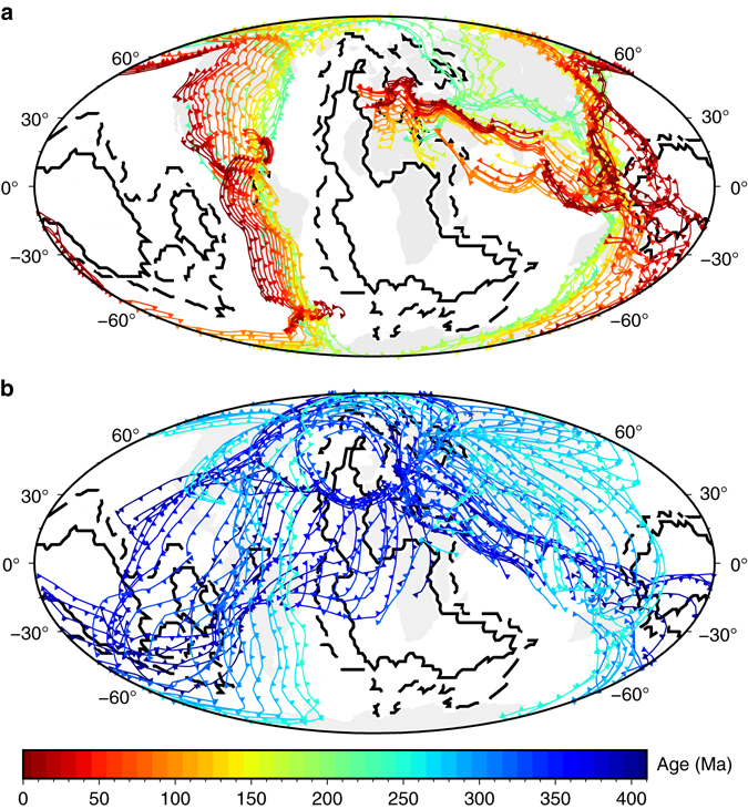
Evolution of the location of subduction zones at 10 Myr intervals in global tectonic reconstructions. a Between 410 and 250 Myr ago based on the reconstruction of Domeier and Torsvik2, in a frame of reference corrected for true polar wander. b Between 230 Myr ago and present based on the reconstruction of Müller et al.4 (reconstruction D in our original article11). Present-day continents are shown as grey polygons. The solid black contour indicates a value of five, and the dashed black contour a value of one in a vote map of the location of LLSVPs in tomography models12