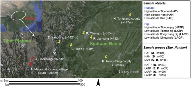
FIGURE 1.

Subject groups and sampling locations. Three high-altitude and seven low-altitude sampling areas were labeled precisely on the Google Earth map using red and yellow indicator marks. (A) Two Tibetan villages in different river valleys of a mountainous area (separately marked on map) where both humans and pigs were sampled. (B–D) City area where urban Han residents were sampled. (E,F) Two pig-farms located in the suburbs of low-altitude cities; Tibetan pigs were transferred from the highland and raised at these farms for 6 months to 2 years. (G) A pig farm in the suburb of Rongchang county raising Rongchang pedigreed pigs. (H) Farmlands on hills near Tongjiang county where Qingyu pigs are raised in a fenced-in open area.
