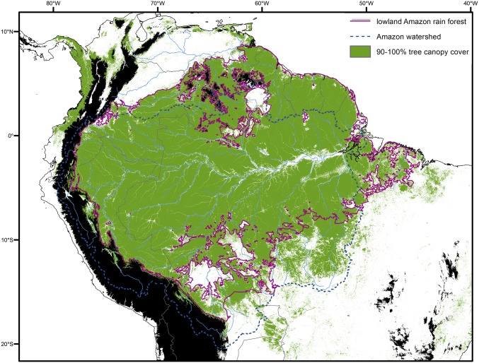
Fig. 2.
Biologically meaningful delineation of the lowland rain forest biome across Amazonia (light-green outline). Areas >1,000 m elevation are shown in black (https://www2.jpl.nasa.gov/srtm/), major rivers are shown by light-blue lines, and the Amazon watershed itself is outlined with a dark-blue dotted line. Areas with >90% tree canopy cover are shown in green based on satellite data from 2000 (45). Our delineation (purple line) was derived by visualizing areas within the multiple watersheds ≤1,000 m elevation that have >1,300 mm annual mean rainfall [slightly below the threshold of Malhi et al. (46)], 18 °C minimum and 24 °C maximum annual mean temperature (lower limit follows the Koppen classification for tropical forests), and climatic water balance (precipitation minus potential evapotranspiration) >0 throughout the year. The northern limit shows complexity, with multiple excluded areas around the tepuis due to high elevation and/or low annual mean rainfall. Large areas highlighted in white, notably in northern Bolivia (Beni savanna/llanos de Moxos) and in the border area of Venezuela, Guyana, and Brazil (Guianan savannas), are excluded due to higher annual mean temperatures (>24 °C). Climatic data were obtained from ref. 47.

