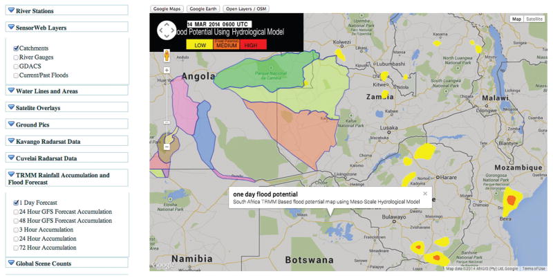
Figure 2.
A screenshot of part of the Namibia Flood Dashboard from 14 March 2014. This image shows water catchments (outlined and colored regions) and a one-day flood potential forecast of the area from hydrological models using data from the Tropical Rainfall Measuring Mission (TRMM), a joint space mission between NASA and the Japan Aerospace Exploration Agency.

