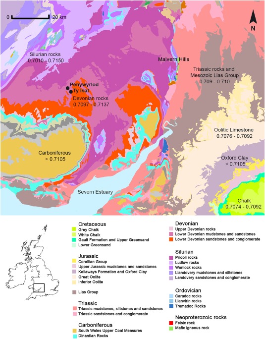
Figure 1.

Map of bedrock geology illustrating sites and locations discussed in the text. Based on British Geological Survey and Ordnance Survey map data, reproduced with permission of the British Geological Survey and Ordnance Survey, © NERC/Crown copyright [2016]. Bioavailable 87Sr/86Sr ranges based on current measured values in Warham (2011: 70–96); Evans et al. (2010); Chenery et al. (2010); Montgomery et al. (2006) and Spiro et al. (2001). Locally bioavailable strontium isotope ratios on Devonian sandstones derived from measured values in plants collected within a radius of 10 miles, approximately 16 km, of Penywyrlod and Ty Isaf (Table 3)
