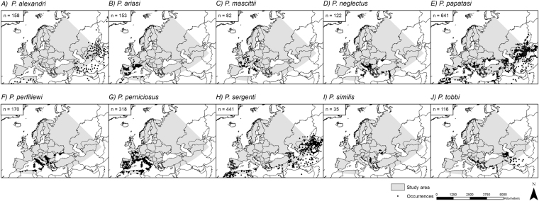
Figure 1.
Observed occurrence points of different sandfly species. Original occurrence data points (n) based on literature searches for all ten sandfly species. Note that the number of occurrence points depicted here is bigger than the number of occurrences used in the models (see also Table 1 and Material and Methods). The grey area shows the considered study area. Projected coordinate system: Europe Albers Equal Area Conic. For visualization, maps were built using Esri ArcGIS 10.377 (www.esri.com/software/arcgis).

