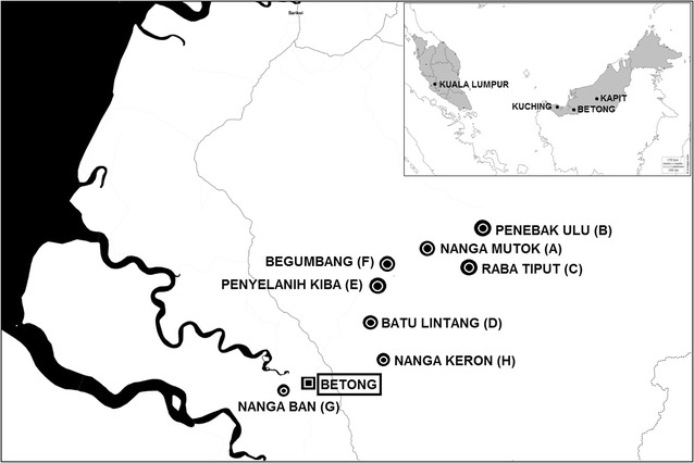
Fig. 1.

Global Positioning System (GPS) coordinates and study identification (ID) of the 8 longhouses selected in this study: Nanga Mutok (A, 1˚36′18.1″N, 111˚40′24.7″E, Penebak Ulu (B, 1˚39′9.2″N, 111˚44′15.3″E), Raba Tiput (C, 1˚35′8.2″N, 111˚42′7.5″E), Batu Lintang (D, 1˚30′24.3″N, 111˚36′11.0″E), Begumbang (E, 1˚34′25.4″N, 111˚38′3.4″E), Penyelanih Kiba (F, 1˚33′7.21″N, 111˚37′19.07″E), Nanga Ban (G, 1˚23′46.9″N, 111˚31′4.1″E) and Nanga Keron (H, 1˚27′11.8″N, 111˚37′54.6″E)
