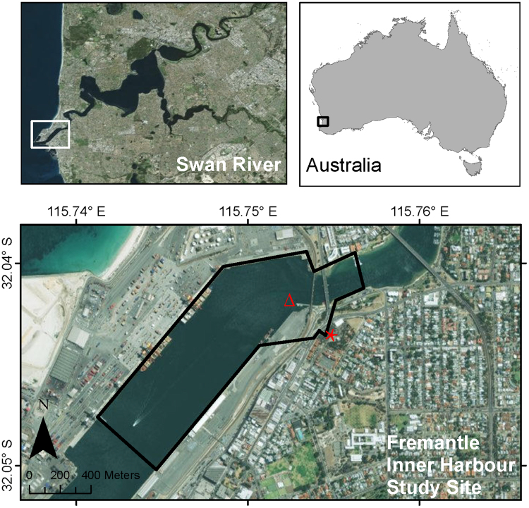
Figure 1.
Map of the Fremantle Inner Harbour study area, showing the location of the theodolite hill-top station (red star) and acoustic logger deployment (Δ). Maps were created in ArcGIS® (version 10.1) by ESRI (www.esri.com) using the World Imagery basemap (sources: Esri, DigitalGlobe, Earthstar Geographics, CNES/Airbus DS, GeoEye, USDA FSA, USGS, Getmapping, Aerogrid, IGN, IGP, and the GIS User Community; http://goto.arcgisonline.com/maps/World_Imagery).

