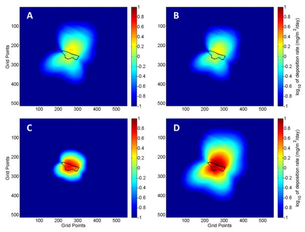
Figure 5.
Maps of predicted dust deposition around the IK mine tailings for three size fractions and PM27 predicted by the DFM for the forecast period 21 April to 22 May 2014. Particle size ranges: (A) PM3.1; (B) PM3.1–PM18; (C) PM18–PM27; (D) PM27. The tailings impoundment is outlined in black. The grid points are spaced by 10.3 m and the domain has a total horizontal extent of 34.47639° to 34.52380° latitude and −112.27639° to −112.22491° longitude. Calculated dust deposition corresponds to dust emitted from the mine tailings.

