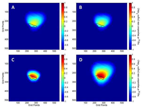
Figure 6.
Maps of predicted dust deposition around the IK mine tailings for three size fractions and PM27 predicted by the DFM for the forecast period 11 June to 9 July 2014. Particle size ranges: (A) PM3.1; (B) PM3.1–PM18; (C) PM18–PM27; (D) PM27. The tailings impoundment is outline in black. The grid points are spaced by 10.3 m and the domain has a total horizontal extent of 34.47639° to 34.52380° latitude and −112.27639° to −112.22491° longitude. Calculated dust deposition corresponds to dust emitted from the mine tailings.

