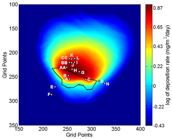
Figure 9.
Map of PM27 deposition predicted by the DFM for the forecast period 11 June to 9 July 2014. The color scale represents the natural log of deposition. The tailings impoundment is outlined in black and the location and sample label of the inverted-disc samplers are indicated. The grid points are spaced by 10.3-m and the domain has a total horizontal extent of 34.49142° to 34.51452° latitude and −112.26247° to −112.23939° longitude.

