
Fig. 5.
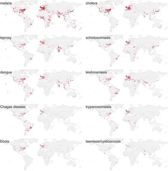
Tropical diseases research 1813–2016. Map of absolute research output on tropical diseases 1813–2016 measured by 253,277 publications in Europe PMC and geoparsed by MapAffil (all on the same QGIS linear heatmap scale with radius 1.25 and maximum value 25). Made with Natural Earth. Free vector and raster map data at naturalearthdata.com