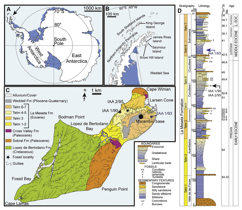
Fig. 1.
Location and stratigraphy of Seymour Island, Antarctica. A, map of Antarctica, showing the position of the Antarctic Peninsula; B, map of the Antarctic Peninsula, showing the location of Seymour Island; C, Geological map of Seymour Island, showing the outcrop of TELMs 5–6 with the localities IAA 1/90, IAA 2/95 and IAA 1/93 of the Eocene La Meseta Formation; D, composite measured section through the La Meseta and Submeseta Formations, showing the stratigraphical position of the sampled localities IAA 1/90, IAA 2/95 and IAA 1/93. Modified from Schwarzhans et al. (2016). Strontium date values from Dingle and Lavelle (1998), Dutton et al. (2002), Ivany et al. (2008), and Reguero et al. (2013).

