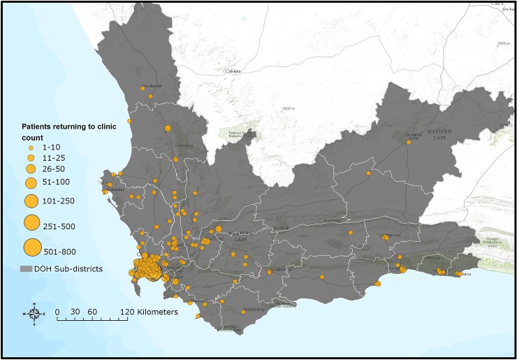
Fig 4. Map of Western Cape province indicating clinics where silent transfers and patients who disengaged returned to care until 30 June 2015.
DOH, Department of Health. Sources: Basemap: Used with permission. Copyright 2017 Esri, ArcGIS Desktop, Western Cape Department of Health, and the GIS User Community. CC BY 4.0. South African Department of Health Layer: Boundaries of the Department of Health Sub-districts falling under the authority of the Western Cape Government and the City of Cape Town municipality (data provided June 2016 by Deputy Director, Information Management Health, Western Cape Government, South Africa). South African public health facilities layer: Locations of facilities falling under the authority of the Western Cape Government and the City of Cape Town. Includes some Inactive facilities as listed in the operational Sinjani system (data provided June 2016 by Deputy Director, Information Management Health, Western Cape Government, South Africa). Software: ESRI 2016. ArcGIS Desktop: version 10.4. Redlands, CA: Environmental Systems Research Institute.

