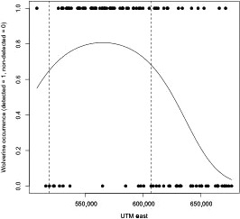
Figure 3.

Estimated wolverine occupancy modeled with UTM east coordinates. Vertical dashed lines correspond to the western and eastern‐most boundaries of the National Parks Complex, refer to Figure 1(a) of study area and park boundaries (Map Datum: Nad 83, Zone 11)
