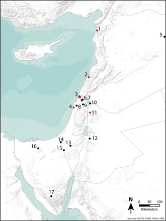
Fig. 1. Map of Levantine EUP sites mentioned in the text.

Sites included in regional chronology are red. The Manot Cave is indicated by a star. 1, Üçağızlı; 2, Ksâr ‘Akil; 3, Manot; 4, Kebara; 5, Wadi Kharar 16R; 6, Hayonim; 7, Meged; 8, Raqefet; 9, Qafzeh; 10, Nahal Ein-Gev I; 11, Mughr el-Hamamah; 12, Tor Sadaf; 13, Boker A/Boker Tachtit; 14, Nahal Nizzana XIII; 15, Qadesh Barnea; 16, Lagama VII; 17, Abu Noshra. USGS, U.S. Geological Survey; ESRI, Environmental Systems Research Institute; TANA, Telugu Association of North America; AND, Automotive Navigation Data.
