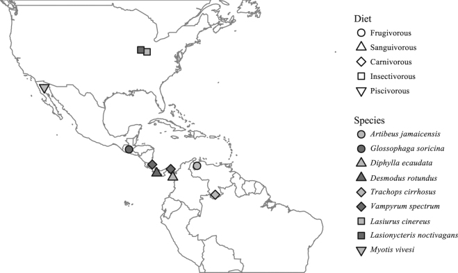
Figure 1.
Locations where samples were obtained from 9 bat species. Map was generated in the R programming language v3.3.1 (R: A language and environment for statistical computing. v3.3.1, R Foundation for Statistical Computing, Vienna, Austria [2016] https://www.r-project.org/)73, using the “maps” package v3.2.0 (http://cran.r-project.org/package=maps)85 and public domain political boundary data published by Natural Earth (http://www.naturalearthdata.com/).

