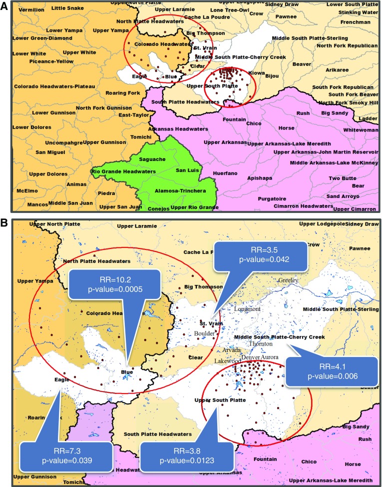
Figure 2.
Significant watersheds for all nontuberculous mycobacteria (NTM) species. The four major watersheds in Colorado are represented by four colors: Missouri (beige), Upper Colorado (brown), Arkansas-White-Red (purple), and Rio Grande (green). Black lines represent watershed boundaries of the four major watersheds. Black line separating the Upper Colorado watershed (brown) from the remaining three watersheds represents the Continental Divide. Statistically significant watersheds are shown in white. (A) Four major watersheds are divided into 92 watersheds (boundaries delineated by gray lines) in Colorado. Watershed names are printed in boldface type. (B) Watersheds narrowed into region of interest. Watershed names are printed in boldface type. Major city names are in printed in gray. Red circles indicate significant clusters of disease caused by all NTM infections. Red dots indicate centroid center of each ZIP code included in the significant cluster. Blue areas indicate lakes, reservoirs, and rivers. RR = risk ratio.

