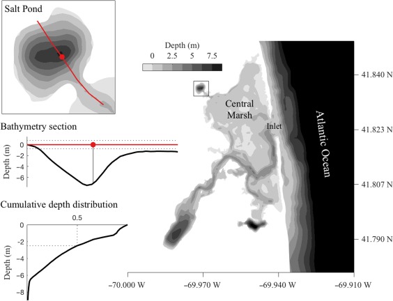
Figure 1.

Bathymetric map of the Nauset Marsh system. Salt Pond is connected to the Atlantic Ocean and other drowned kettle holes within the marsh through a network of shallow channels within a central marsh area. Upper left: Salt Pond bathymetry. The red line indicates a section that passes through the location of the observatory raft (red circle) and is represented in profile in the middle left bathymetry section. Lower left: Cumulative distribution of bottom depths within Salt Pond. About half the pond is ≤ 2 m deep.
