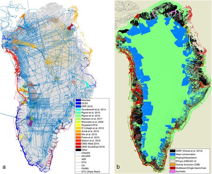
Figure 1.

(a) Data coverage, including ice‐penetrating radar measurements (Center for Remote Sensing of Ice Sheets, High CApability Radar Sounder, University of Denmark, Uppsala University, Pathfinder Advanced Radar Ice Sounder, Alfred Wegener Institute) and ocean bathymetry (from single‐beam data in dark blue), and (b) BedMachine v3 bed topography sources, which include mass conservation (MC), kriging, Greenland Ice Mapping Project (GIMP) (Howat et al., 2014), RTopo‐2/IBCAO v3 (Jakobsson et al., 2012; Schaffer et al., 2016), and bathymetry data from multibeam and gravity inversions acquired after the compilation of IBCAO v3.
