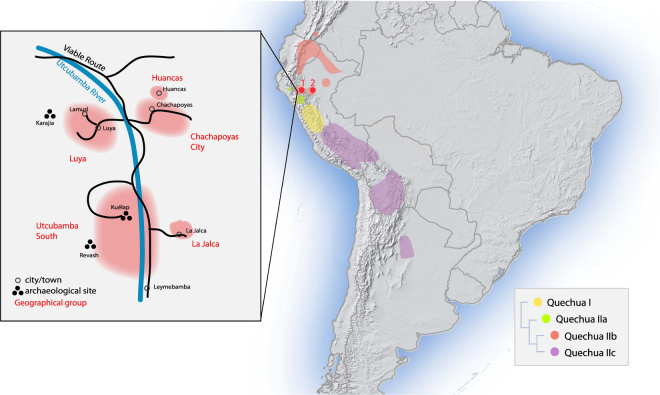
Figure 1.
Map of sampling locations and approximate distribution of sub-branches of the Quechua language family, as traditionally classified (Adapted from13). Red dot 1 marks the sampling locations in the Amazonas region (Chachapoyas City, Luya, Huancas, Utcubamba South, La Jalca); red dot 2 marks that in the San Martín region (Lamas, Wayku neighbourhood). The inset zooms in on the sampling locations in Amazonas. Map generated in R - version 3.3.0 www.R-project.org/ 62. Raster physical map adapted from www.naturalearthdata.com/ (public domain).

