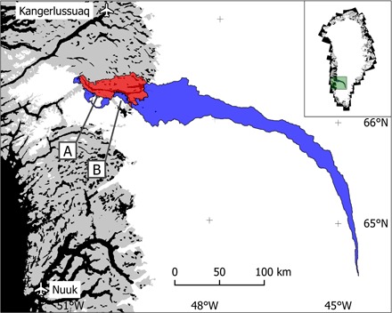
Fig. 1. The Tasersiaq catchment in southwest Greenland.

Red, ice-free part of the catchment; blue, ice-covered part of the catchment; A, unnamed ice-dammed lake delivering glacial lake outburst floods (GLOFs) to the catchment (subtracted from the discharge time series); B, Amitsulôq ice cap. Inset: map location in Greenland shown in green. A more detailed map of the outlet region is provided in fig. S1.
