FIG. 7.
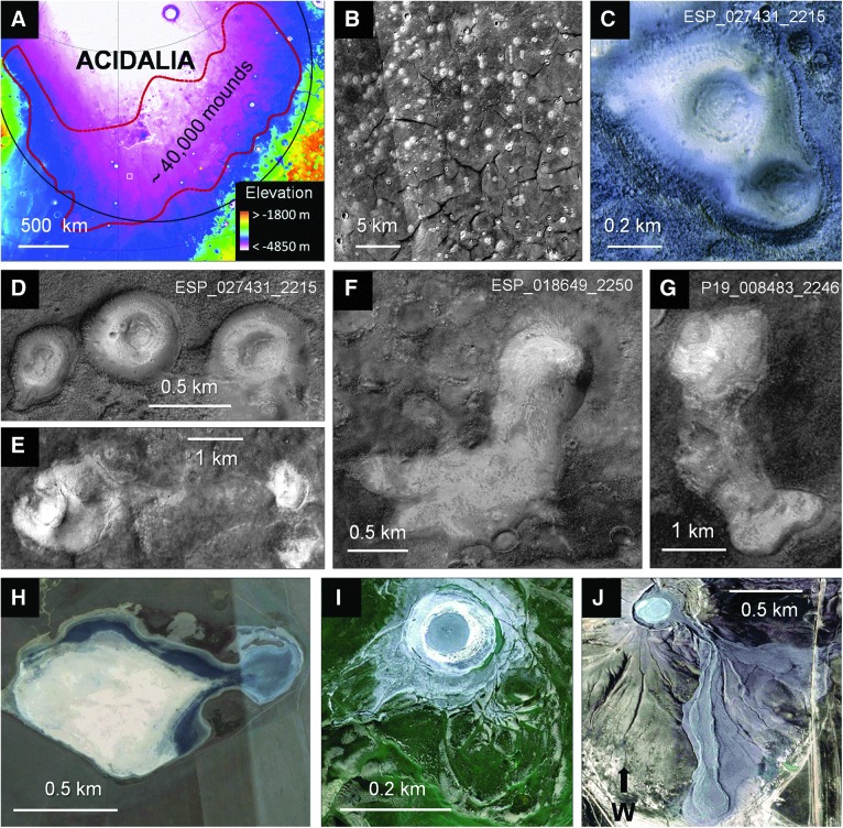
Mud-volcano-like mounds in Acidalia and comparative mud volcanoes on Earth. Acidalia mounds (A–G): (A) Acidalia basin on MOLA basemap. Red outline is area within which ∼40,000 mud-volcano-like mounds are estimated (Oehler and Allen, 2010). Small white square is the area of (B). (B) CTX mosaic of white square in (A), illustrating abundance of bright mounds and their association with giant polygons. (C–D) HiRISE images showing details of Acidalia mounds (moats and central depressions with concentric outlines). (E–G) Acidalia mounds with flows onto the plains: (E) Image from CTX mosaic of mound with flow to east; (F) HiRISE image; (G) CTX image. Terrestrial mud volcanoes (H–J): (H) Google Earth image of Krasnopolskaya mud volcano in Crimea showing irregular limits of flow into depression; (I) Google Earth image of mud volcano in Azerbaijan showing concentrically bordered central area, surrounding moat, apronlike extensions of mud onto the plains, and older flows to the southeast. (J) Google Earth image of mud volcano in Azerbaijan showing concentrically bordered, central region and long, current flows to the east and northeast. North is up in (A–I) and to the right in (J). Centerpoints: (A) 46.22°N, 333.53°E; (B) 40.56°N, 332.88°E; (C) 44.02°N, 340.45°E; (D) 41.23°N, 333.68°E; (E) 46.72°N, 340.35°E; (F) 44.79°N, 331.72°E; (G) 44.57°N, 317.13°E; (H) 45.10°N, 36.25°E; (I) 40.52°N, 49.02°E; (J) 40.38°N, 49.62°E. Image credits: Acidalia images: (A) MOLA basemap, NASA/JPL-Caltech/GSFC; (B) Google, NASA/USGS and NASA/JPL/MSSS; (C–D, F) NASA/JPL/University of Arizona; (E) Google, NASA/USGS and NASA/JPL/MSSS; (G) NASA/JPL/MSSS. Earth images: (I) Google, 2016 Digital Globe; (H, J) Google, 2016 CNES/Astrium.

