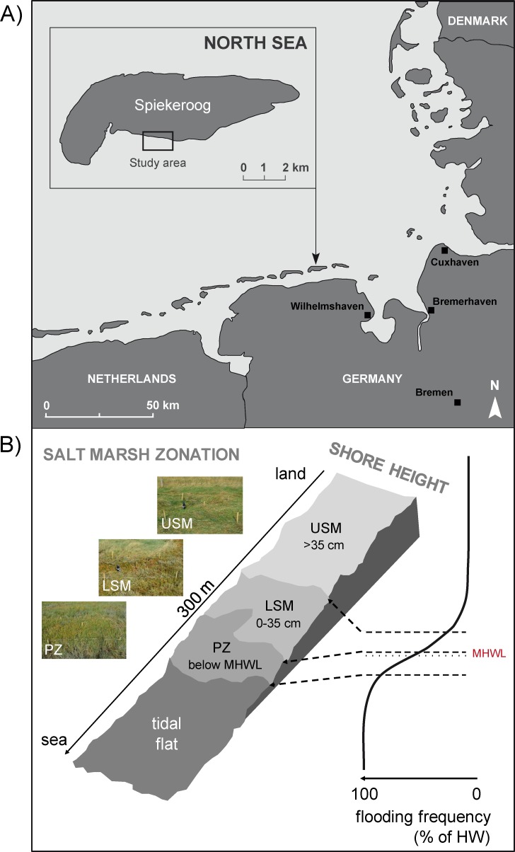
Fig 1.
(A) Map of study area: Spiekeroog, East Frisian Islands, Germany, North Sea. (B) Salt marsh zonation: upper salt marsh (USM, >35 cm above MHWL), lower salt marsh (LSM, 0–35 cm above MHWL) and pioneer zone (PZ, below MHWL) from the land to the sea in relation to shore height and frequency of inundations (USM: 35–70 times a year, LSM: 150–250 times a year, PZ: inundations twice a day).

