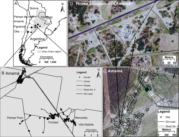
Fig 1. Map of the study areas, illustrated by the example of the Amamá study area, to be read counterclockwise from the upper left corner.
(A) Gran Chaco region of northwest Argentina and neighboring countries, including the four study areas (Amamá, Olta, Figueroa, and Pampa del Indio). (B) Amamá study area core (Amamá village, Trinidad, Mercedes, Villa Matilde and Pampa Pozo). (C) Amamá village, showing individual sites (open circles). (D) One house compound in Amamá village, showing individual buildings.

