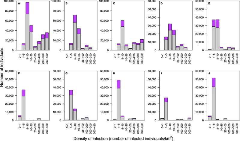
Fig. 4. Geographic dispersion pattern of HIV-infected individuals for each healthcare district (HCD).

Histograms show the distribution of the population (15 to 49 year olds) as a function of the DoI: purple data represent HIV-infected individuals, gray data uninfected individuals. (A) Maseru HCD, (B) Leribe HCD, (C) Berea HCD, (D) Mafeteng HCD, (E) Mohale’s Hoek HCD, (F) Mokhotlong HCD, (G) Butha-Buthe HCD, (H) Quthing HCD, (I) Qacha’s Nek HCD, and (J) Thaba-Tseka HCD.
