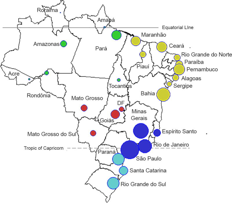
Figure 1.
Map of 26 administrative states plus the Capital District ("DF"). The location of each capital is represented by circles, where the size of the symbol is proportionate to the population size of each state (log10 scale). The colors refer to the five Brazilian administrative regions: North (green), Northeast (yellow), Central West (red), Southeast (dark blue), and South (light blue)

