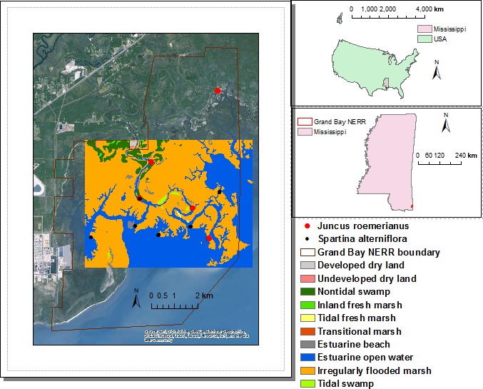
Figure 2.

The study area (rectangle in the middle of left panel), mainly in the middle of Grand Bay NERR, with the sampling locations for above‐ground biomass and 1988 NWI map. The inset on the upper left shows the detailed sampling method for a location. The Grand Bay NERR is located in Southeastern Mississippi in Southeastern US (the US map is from the CENSUS, the Mississippi state map is from the Mississippi Automatic Resource Information System, the reserve boundary is from the NERR centralized data management system, the background for the map on the left panel comes from Environmental Systems and Research Institute, and the legend of land cover is for the study area only)
