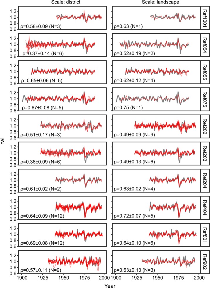
Fig 4. Comparison of the ring-width index (rwi) from ten crossdated reference chronologies (grey) against neighbouring new chronologies (red) built at the district scale (median area: 203 km2) and landscape scale (median area: 2,259 km2) grouped by soil physical environment type.
Only chronologies located within a 40-km radius (district scale) or 80-km radius (landscape scale) of the reference chronologies were used. Radius was determined as the distance between the centroid of the spatial unit and the location of the stand sampled for the reference chronology. Average Spearman correlations (ρ) and associated standard deviations are shown.

