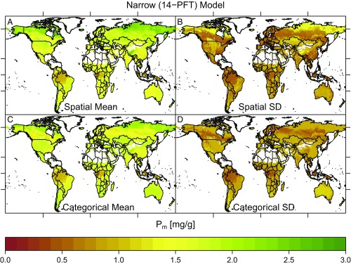
Fig. 4.
Phosphorus (mass) maps. (A and B) Narrow (14-PFT) Bayesian spatial model pixel mean and SD estimates, respectively. (C and D) Narrow (14-PFT) categorical model pixel mean estimates and SD estimates, respectively. For clarity, the color bars have been truncated at the compound 5th and 95th percentiles of both models. Latitude tick marks indicate the equator, tropics, and Arctic Circle and longitude is marked at 100°W, 0°, and 100°E.

