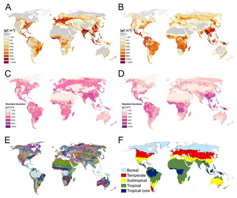
Extended Data Figure 5. Land-use induced difference in potential and actual biomass stocks, uncertainty of input data and vegetation units used in the study.
A) Impact of land-cover conversion, B) impact of land management. A) and B) maps are based on the FRA-based actual biomass stock map and the corresponding, IPCC-based FRA-adjusted potential carbon stock map. C) Standard deviation of potential biomass stocks maps (n=6), D) Standard deviation of actual biomass stock maps (n=7). E) Intersect of all three37–39 biome maps used in the ecozone approaches and for the construction of the RS-based potential biomass stock map. F) FAO Ecozones37 used for the aggregation of results. The “tropical core” consists of humid rainforests. The tropical zones contains moist deciduous forests, dry forests, and tropical shrubs.

