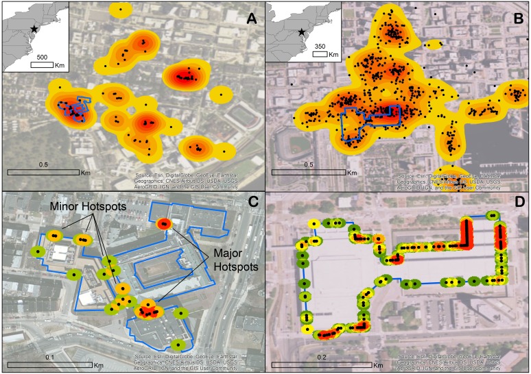
Figure 2. Two examples of urban areas in the United States where extensive bird-window collision survey data reported to iNaturalist allow for the identification of hotspots via kernel density.
University of Pennsylvania in Philadelphia (A) and downtown Baltimore (B) with perimeters of focal buildings outlined in blue. Collision points snapped to the perimeters of the Ryan Veterinary Hospital-Veterinary Medicine Old Quad-Rosenthal-Hill Pavilion complex (C) and the Baltimore Convention Center (D) with applied point density function to highlight most collision-prone segments of façade.

