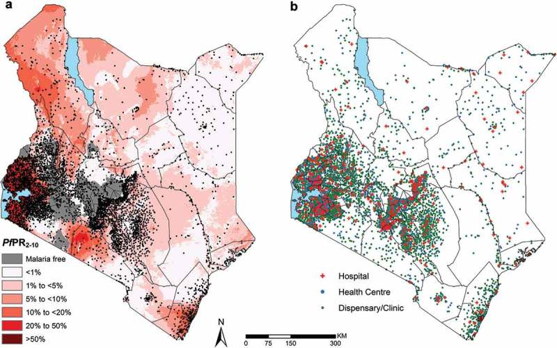
Figure 2.

Distribution of the 5782 geocoded public health facilities in DHIS2 with coordinates out of the 5933 public facilities. (a) – Location of all facility types overlaid on a malaria endemicity map of Plasmodium falciparum prevalence in 2015 among children 2–10 years of age (PfPR2-10) in Kenya at 1 × 1 km spatial resolution [31] (b) Map showing the location of facilities categorized by facility types.
