
Fig. 1.
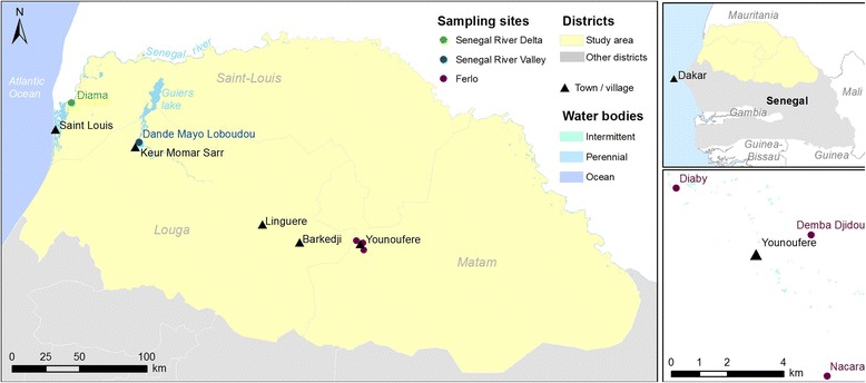
Location of the three sampling sites in northern Senegal. Top-right corner: Senegal map and area of interest (in yellow). Main figure: triangles represent main towns/ villages nearby the sampling sites, while full circles correspond to the sampling points. Bottom-right corner figure: detail of the positions of the three sampling points in Younoufere