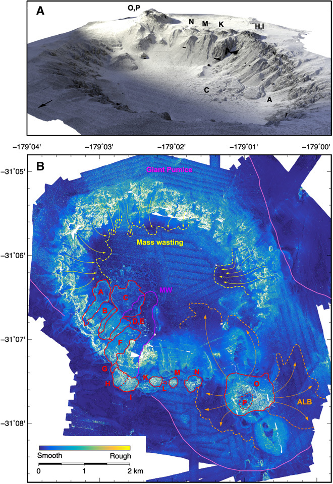
Fig. 2. Two-dimensional surface roughness map and three-dimensional rendering of Havre submarine volcano.

(A) Three-dimensional surface rendering of the Havre submarine caldera, view looking from the northeast. Lavas distributed on the southern margin of the caldera are labeled [see (B)]. The width of the caldera is 4.5 km. (B) Seafloor roughness, derived from the gridded AUV bathymetry by calculating the surface area in 3 × 3 m bins relative to a flat seafloor. As expected, the steep caldera walls show high roughness. The lavas and domes (outlined in red and labeled A to P) are distinguished by high roughness. The sediment at the lava flow front of lava C is wrinkled. A coarse deposit interpreted as the product of syneruptive mass wasting is located within the caldera extends north-northeast from the truncated edges of lavas G to I (MW in red). The widespread GP deposit has moderate roughness on the caldera floor and flanks and is outlined by solid pink lines. Areas within the GP deposit that are less rough are partially or wholly buried by ALB, and later deposits are derived from the collapse of dome O-P (dashed orange lines). Dashed yellow lines enclose parts of the GP deposits covered by syn- and post-eruption mass-wasting deposits inside the caldera.
