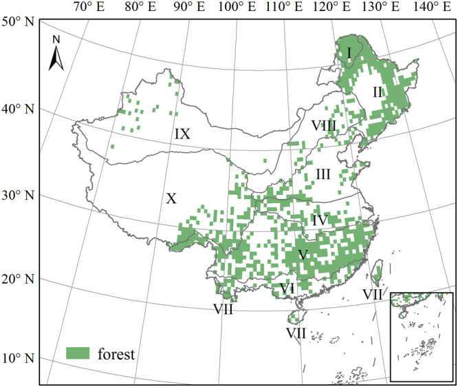
Figure 1.

Forest distribution and eco-geographical regions in China. I: Cold temperate humid region; II: Mid-temperate humid/sub-humid region; III: Warm temperate humid/sub-humid region; IV, Northern subtropical humid region; V: Mid-subtropical humid region; VI: Southern subtropical humid region; VII: Tropical humid region; VIII: North semi-arid region; IX: Northwest arid region, and X: Tibetan Plateau region. The forest distribution data were obtained from the 1:1000000 vegetation map of China42. The eco-geographical regions boundary was adopted from Zheng43. The figure was generated using ArcGIS 10.1 software (http://www.esri.com/).
