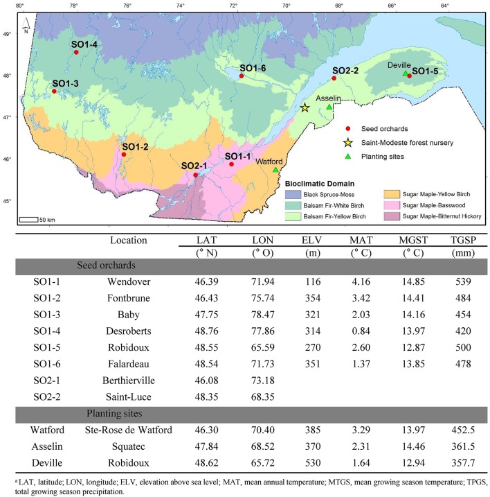
Figure 1.
Map of Quebec showing the location, coordinates and climatic data for the eight white spruce seed orchards (SO) that were used as seed sources in this study as well as the three planting sites (Watford, Asselin, and Deville). For SO1-1 to SO1-6, latitude, longitude, and elevation of the seed orchards are those of the centroid of selected trees that make up the orchards. The climatic data corresponds to those of the same centroids for the period 1981–2010. For seed orchards SO2-1 and SO2-2, only latitudinal and longitudinal data of orchard locations are presented because the orchards were composed of trees representing multiple widespread provenances from Québec and Ontario in Canada.

