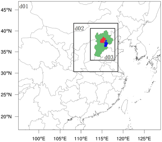
Figure 1.

Triple nesting domains for computational implementation of the CMAQ model: d01 covers most of China and part of East Asia with the resolution of 36 × 36 km; d02 covers the Northern China Plain (NCP) with the resolution of 12 × 12 km; d03 covers the Beijing-Tianjin-Hebei (BTH) region with the resolution of 4× 4 km. Green, orange, and blue colors represent Heibei, Beijing, and Tianjin, respectively. The maps were created by NCAR Command Language (NCL) (http://www.ncl.ucar.edu/).
