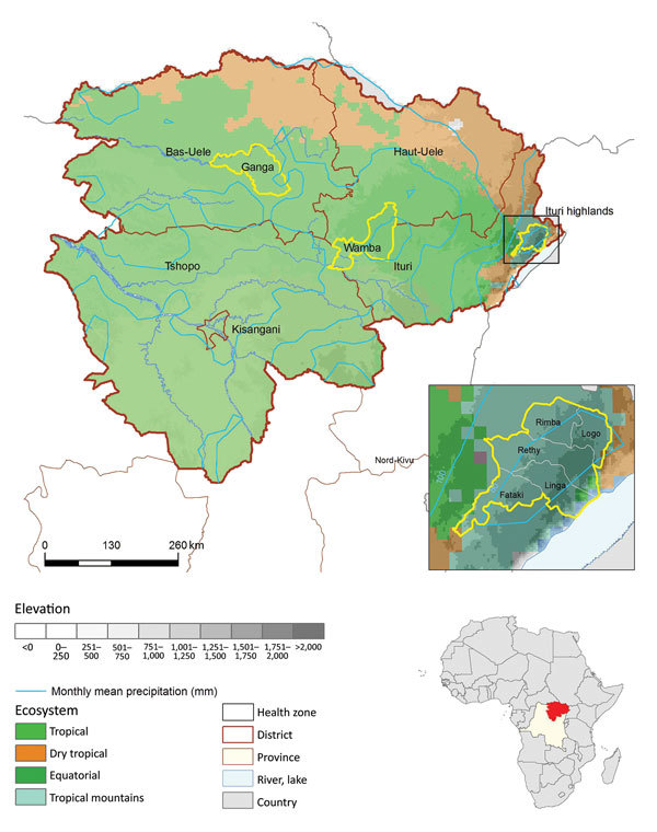
Figure 2.

Location of spatial clusters of bubonic and pneumonic plague, Orientale Province, Democratic Republic of the Congo, 2004–2014. Yellow circles indicate clusters of health zones determined by spatial scan analysis. p values were <0.001, except for Wamba (p = 0.053). First inset shows the Ituri cluster constrained by frontiers; Oliveira F was 1 for Linga, Logo, Rethy, and Rimba and 0.69 for Fataki. Second inset shows location of DRC in Africa. The 4 ecosystems follow those described at http://www.fao.org/ag/AGAInfo/programmes/documents/livatl2/Ecosystems.htm (Technical Appendix Table).
