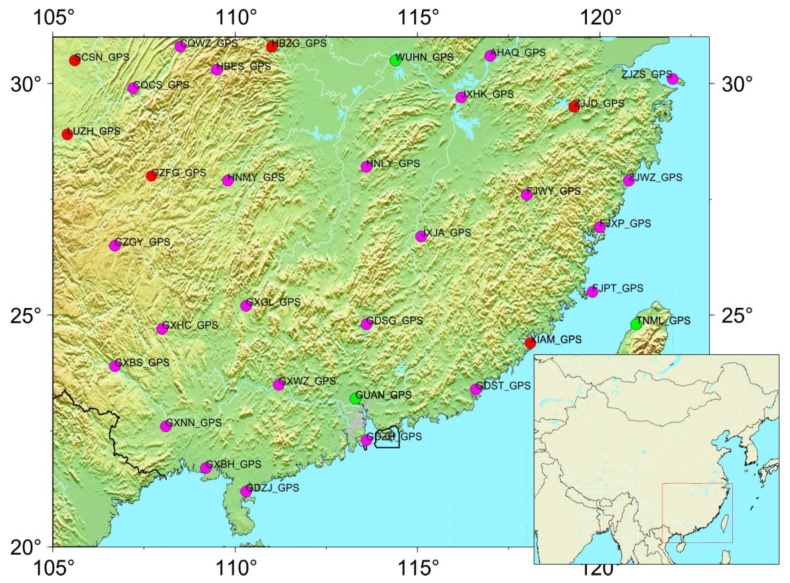
Figure 1.
The distribution of GPS stations in and around the South China block (SCB). The magenta circles are the CGPS stations with records spanning from March 2010 to July 2016, and the green dots are the CGPS stations with records spanning from January 1999 to July 2016. The red dots are selected for comparison with GRACE-inferred loading displacement. The map in the inset shows the location of the SCB.

