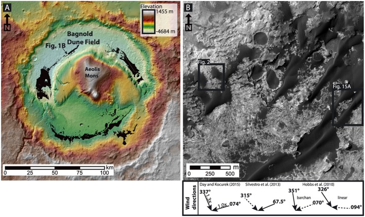
Figure 1.

Location map of Gale crater, Mars showing (a) the distribution of dune fields and sand sheets within Gale crater mapped on an High/Super Resolution Stereo Color Imager‐generated DEM (modified from Day and Kocurek [2015]) and (b) HiRISE satellite image of the study area of Bagnold Dune Field discussed in this work. The study area consists of barchan dunes on the north‐northwest flank of the dune field that transition to the southwest into linear dunes. Wind directions over this region as inferred by various authors are shown below Figure 1b. Images: HiRISE ESP_018854_1755.
