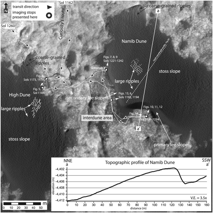
Figure 2.

Location map showing the ingress and egress of Curiosity to the field area for the Bagnold Dune campaign (white stippled line; black arrows with white boarder indicate traverse and drive direction). The location of the major stops discussed in this study are noted by white and black circles and labeled by the sols on which the images used in this study were acquired. The location of the figures used throughout the manuscript are labeled along with dune slopes and representative mapping of sedimentary processes visible from HiRISE images. The inset graph shows a profile across Namib Dune to highlight the typical asymmetric dune shape and demonstrate the incline of the underlying bedrock. Images: HiRISE ESP_018854_1755; HiRISE DEM: DTEEC_040770_1755_039280_1755_A01 (1 m/pixel spatial resolution); and HiRISE ESP_039280_1755 was used for dune and ripple measurements collocated with the DEM but is not displayed.
