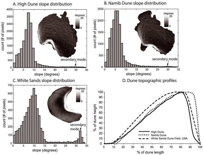
Figure 3.

Distribution of slopes on Namib and High Dunes and on a terrestrial barchan dune. Histograms of dune slopes of (a) High Dune, (b) Namib Dune, and (c) White Sands Dune Field, New Mexico, USA show approximately the same stoss slope modes in their distribution. A secondary lee slope mode occurs at the same slope across all histograms, but is somewhat lower and less prominent in the Martian dunes. A black arrow and notation indicating the secondary mode are shown on the histograms. A slope map of the dune cropped from the DEM is subset within each histogram plot. (d) Dune topographic profiles normalized by their length and height for Namib and High Dunes are similar to a representative barchan dune profile from White Sands. Images: HiRISE DEM: DTEEC_040770_1755_039280_1755_A01 (1 m/pixel spatial resolution) (Figures 3a and 3b) and 2010 airborne lidar‐derived DEM of White Sands (www.opentopography.org) (Figure 3c).
