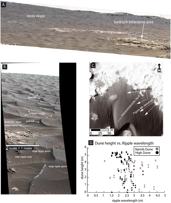
Figure 4.

Mastcam and HiRISE images of the stoss slope of High Dune. (a) Mastcam image showing the stoss slope of High Dune and the transition from the bedrock interdune area to the stoss slope. (b) Mastcam image showing ripples at High Dune. Note the sinuous large‐ripple crest lines, impact ripples superimposed on the large ripples, and grainfall on the SE side of the large ripples. (c) HiRISE image showing the approximate same area as the Mastcam images. The largest ripples at the base of High Dune are brighter and straighter crested than those higher on the dune. (d) Plot of position of ripple on relative dune elevation versus wavelength along the stoss slope of Namib and High Dunes shows the lack of a trend in wavelength up the slope. This differs from superimposed dunes on Earth, which change wavelength over distance [Ewing and Kocurek, 2010]. Images: mcam05312, Sol 1173 (Figure 4a); mcam_05329, Sol 1176 (Figure 4b); HiRISE image: ESP_018854_1755 (Figure 4c); DTEEC_040770_1755_039280_1755_A01 (1 m/pixel spatial resolution) and HiRISE ESP_039280_1755 were used for the collocated dune and ripple measurements but are not displayed.
