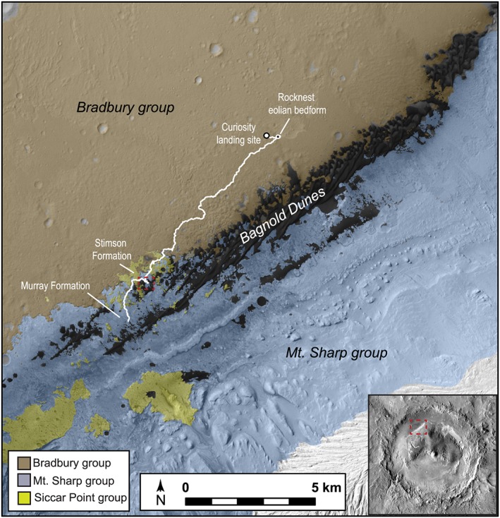
Figure 1.

Overview of the study area, showing the Bagnold dune field, rover traverse through sol 1550, and key rock units: the Bradbury group (Aeolis Palus) with its interbedded sandstones, the Siccar Point group (including the Stimson sandstone formation), and the Mount Sharp group (including the Murray formation). Geologic mapping is from Grotzinger et al. [2015] and Fraeman et al. [2016] on a Mars Reconnaissance Orbiter Context Camera image basemap. The dashed red box shows the location at which the Bagnold dunes campaign was conducted and is the approximate location of Figure 2. The inset shows the location of this scene within Gale crater.
